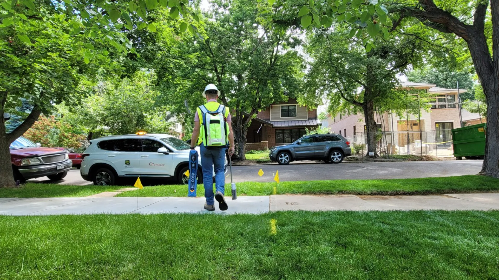
Underground Locating
Olameter provides utility locating services for gas electric water sewer traffic signals and communications in both the US and Canada.
Locating and Marking Utilities
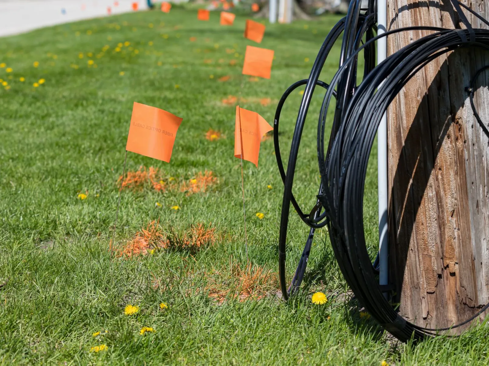
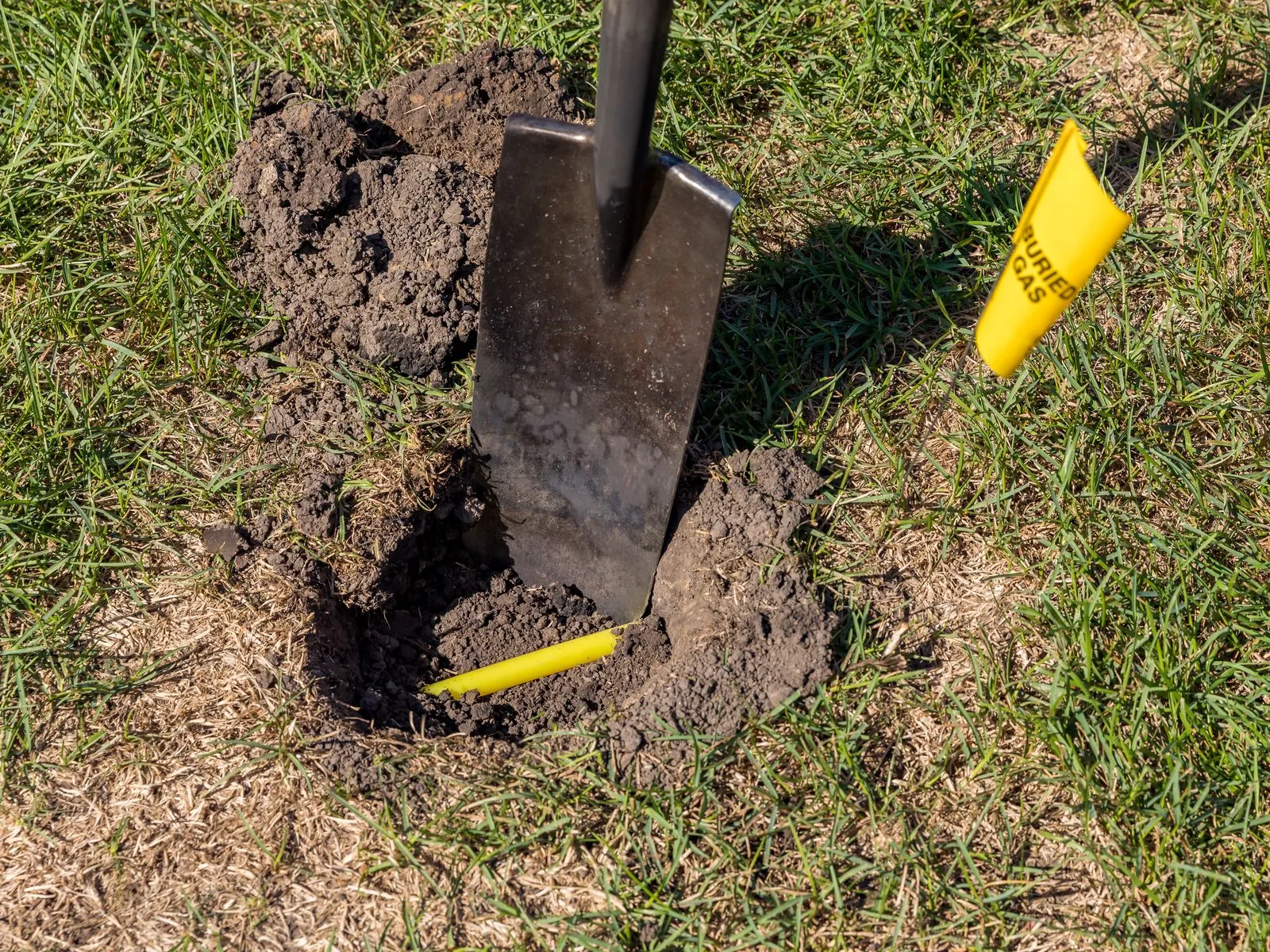
Sites are marked with paint, flags, and stakes, including the option of offset marking using industry-standard conventions so that excavators will not inadvertently damage nearby facilities as they excavate. Tickets can be completed with sketches for reference in the field. We are capable of converting all data gathered in the field into formats suitable for the clients' asset databases and for updating their as-built drawings. We can also provide GPS mapping of locates performed in the field.
As a locating contractor, we understand the importance of having a locate done properly - and safety is our number one concern. Our technicians undergo considerable training in order to master locating techniques and to have practical knowledge of how the buried facilities were originally constructed. A syllabus with comprehensive testing has been developed for Olameter employees by Staking University, a leading state-of-the-art locate training facility. Our technicians are audited and certified on a yearly basis. Olameter's ticket management system assigns and redistributes workloads to our technicians in the field. Our system allows ticket progress to be tracked in real-time.
Benefits resulting from the use of this system include:
- All field technicians receive tickets via real-time wireless or internet on their company laptops
- Full compatibility with One-Call Centers and customer ticket management systems including the ability to respond to both
- Real-time Positive Response to the excavator via fax or e-mail
- All events associated with the ticket are aptured in the ticket history
- Clients are granted full access to the system
Locate Techniques
Locating is accomplished using one of the following basic techniques:
- Electromagnetic detection
- Ground-penetrating radar
- Field measurement based on client data
- Inductive methods
- Vacuum excavation

Electromagnetic Detection
Electromagnetic detection is the most common location method used. Olameter uses equipment furnished by vendors such as RadioDetection, Ditch Witch, and Vivax-Metrotech. These devices measure the changes to magnetic fields detectable at ground level, which are caused by fluctuating currents in electrically conductive pipes and wires buried at the site. The current may be native to a buried object (power or co-axial cable line), induced by a physical electrical connection at one end and a ground at some distance (gas, water, fiber-optic tracer wires), or generated by magnetic induction.

Ground-Penetrating Radar
Ground-penetrating radar are techniques that have been used by geophysicists for several decades.The technician induces an electromagnetic pulse and measures the timing and direction of the echo. The viability of the technology is greatly affected by soil conditions; dry-sandy soils (largely non-conducting) being most advantageous. Olameter uses equipment provided by Sensors & Software Inc.

Hydrovac Excavation
Hydrovac excavation is a physical inspection technique that involves a pair of specialized hoses: one that injects water from a nozzle at high pressure, and another that sucks the water and all loosened debris away. This process excavates a borehole that may be up to 20 feet deep. The equipment, water tank, and slurry (disposal) tank are delivered to the site on a specialized truck. Waste materials are brought to local regulated sites for disposal. Pictures are taken down the borehole to confirm the presence of buried infrastructure. Once the process is completed, the hole is then backfilled with clean material. This technique, which is designed to be non-destructive, should not be confused with hydraulic fracturing.

Field Measurement Based on Client Data
Field measurement involves using traditional site survey tools to mark the site's surface based on measurements relative to surface features (buildings, curbs, etc.) as on drawings supplied by the client. This may be required at sites that are particularly congested, and is always a last resort.
Quality and Safety
All of our locate personnel adhere to rigorous quality and safety standards through regular audits focused on ensuring excellence in performance, environmental responsibility, and workplace safety. Additionally, all company vehicles are equipped with GPS and are monitored 24/7 to maintain operational efficiency and enhance safety in the field.